
Vynsane's Travelogue: Pacific Northwest Edition
-
brickarmor
- Knight

- Posts: 376
- Joined: Mon Apr 30, 2012 7:08 am
- Location: SC, US
Re: Vynsane's Travelogue: Pacific Northwest Edition
Simply stunning, thanks again for sharing. I'm starting a penny jar now so I can save up and go back.


Re: Vynsane's Travelogue: Pacific Northwest Edition
Yeah, there are quite a few places that I want to revisit, and Crater Lake will be at or near the top of the list for a long time to come.
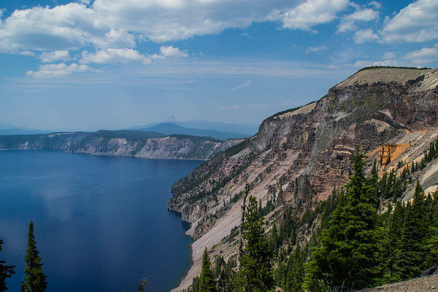
One of the most massive and impressive features of Crater Lake is Llao Rock, the highest point of the rim, rising nearly 2,000' above the water. Formed of lava that flowed from Mount Mazama before its collapse into the caldera, it's an immense slab of dacite that survived the cataclysmic eruption ~7,700 years ago that formed the lake. The color and nature of the rock makes it apparent why it was named for the Klamath tribe's God of the Under-World, Llao, who, according to legend, inhabited Mount Mazama and was buried beneath the collapsed mountain by Skell, God of the Above-World after the two battled by hurtling red rocks back and forth between Mount Mazama and what is now known as Mount Shasta in northern California. This legend is used to indicate that the Klamath Tribe was actually present to witness the eruption that formed the caldera.
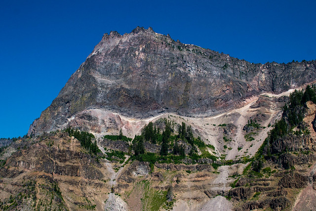
Llao Rock by vynsane, on Flickr
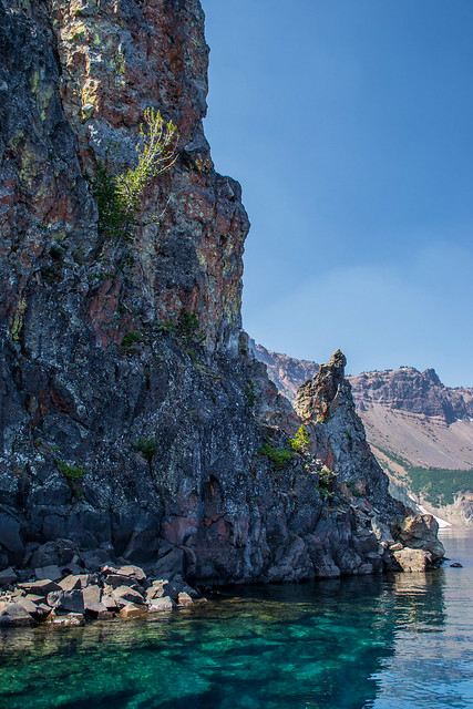
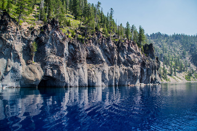
The Elephant Dike is a dacite formation that was uncovered by the collapse of Mount Mazama. Its name is in reference to the bulbous gray formation to the right of the reddish-brown stripe (which can be viewed as the head of an elephant), and the thin strip of dacite that flows downward toward the water (the trunk).
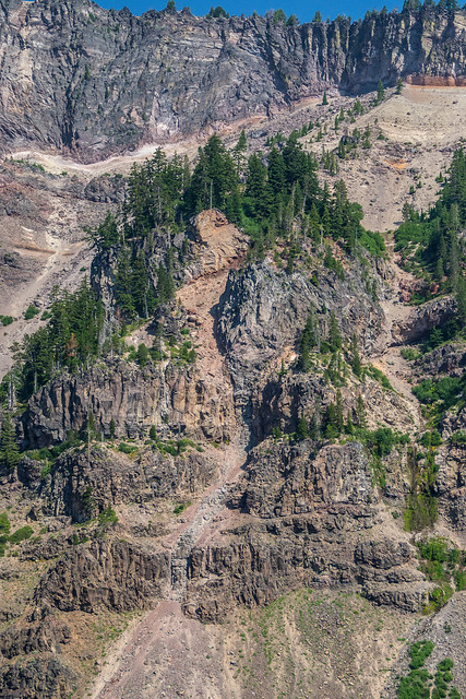
Elephant Dike by vynsane, on Flickr
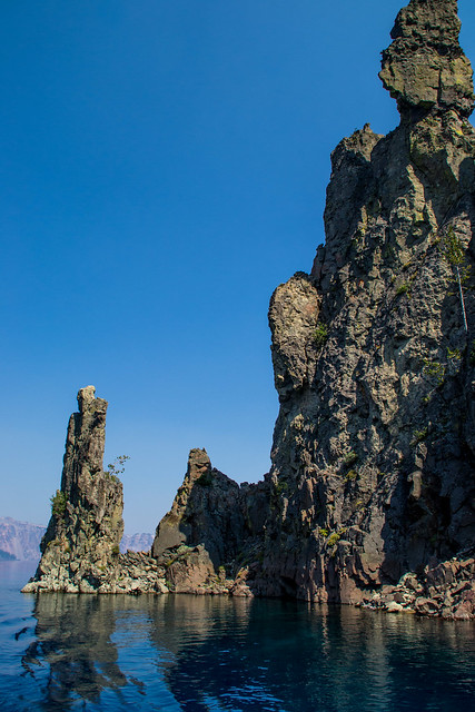
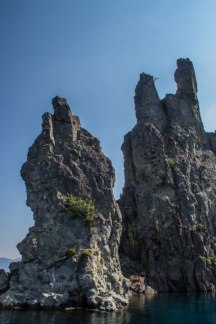
Devil's Backbone is another dacite dike, and the only one that extends from the water's edge to the rim of the caldera.
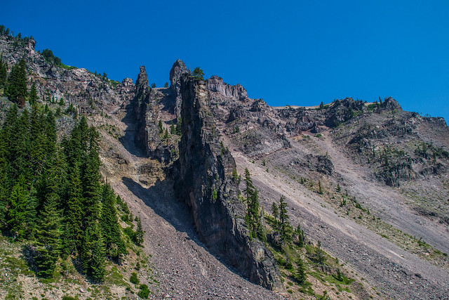
Devil's Backbone by vynsane, on Flickr
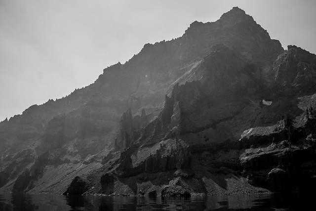
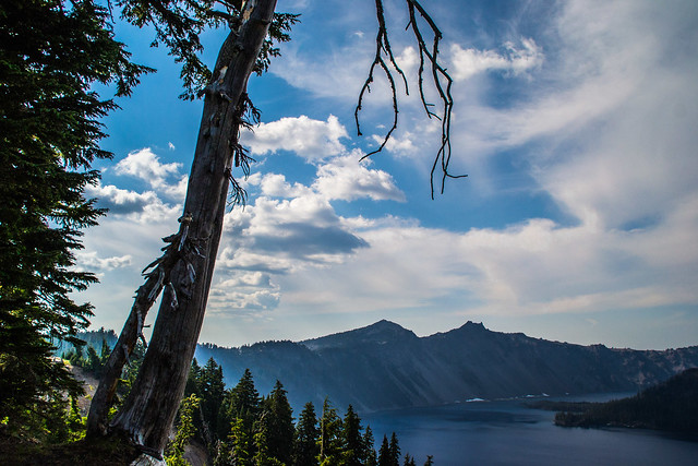
I honestly don't know if this formation has a name, and what it is if it does, but it looks really cool.
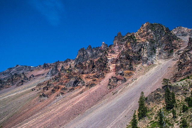
alien landscape by vynsane, on Flickr
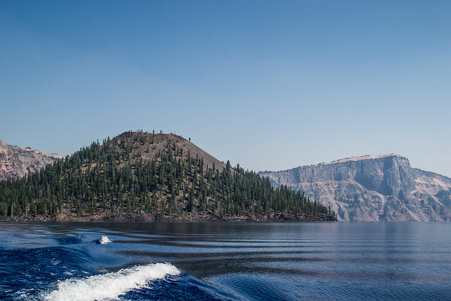
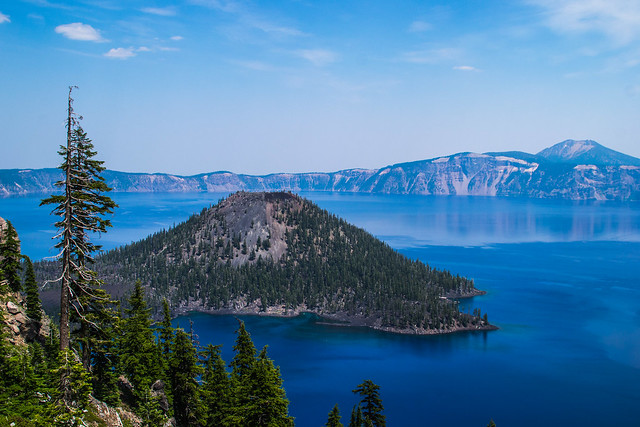
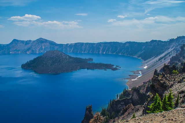
Wizard Island is one of two islands inside the caldera lake and is the only one suitable for people to explore. A volcanic cinder cone that developed within the basin of the caldera sometime after its eruption, it encompasses some 315.85 acres total. The top of the island reaches 6,933 feet (2,113 m) above sea level, about 755 feet (230 m) above the average surface of the lake. The cone is capped by a volcanic crater about 500 feet (150 m) wide and 100 feet (30 m) deep.
Wizard Island b&w by vynsane, on Flickr
One variation of the Klamath Tribe legend between Skell and Llao ends with Wizard Island being formed from Llao's disembodied head, after Skell fooled Llao's followers into devouring his quartered arms and legs.
Wizard Island and Llao Rock by vynsane, on Flickr
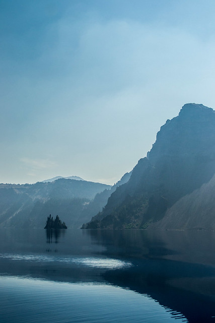
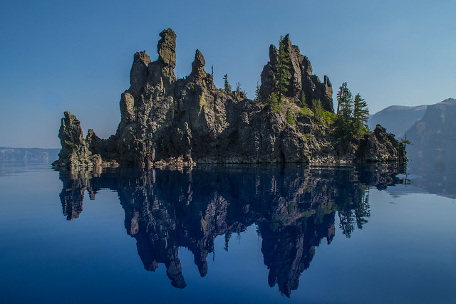
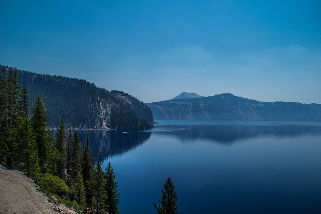
The other island inside the caldera lake, The Phantom Ship, is made up of volcanic ejecta and 400,000 year old andesite lava. The hull of the "ship" is formed of volcanic ejecta, while the masts are part of a giant dike. The Phantom Ship was part of a 400,000 year old formation known as "The Phantom Cone", a precursor to the great Mt. Mazama. It was the first major volcano which erupted in the general vicinity of Mt. Mazama.
Although the Phantom Ship looks diminutive from the edge of the rim, in reality the feature is quite large. The island rises 163 feet above the surface of the lake, as high as a 16 story building. The island is about 300 feet long.
Distant Phantom Ship by vynsane, on Flickr
Crater Lake is isolated from surrounding streams and rivers, thus there is no inlet or outlet to the lake. Its primary input is from annual precipitation in the region. Average annual precipitation is 168 cm (66 in); average annual snowfall is 13 m (44 ft). It took approximately 250 years for the lake to fill to today's level (~1,883 m or ~6,178 ft above sea level). The lake maintains its current level because the amount of rain and snowfall equals the evaporation and seepage rate. Lake level has varied only over a range of 5 m (16 ft) in the past 100 years.
slow-release refill by vynsane, on Flickr
One of the most massive and impressive features of Crater Lake is Llao Rock, the highest point of the rim, rising nearly 2,000' above the water. Formed of lava that flowed from Mount Mazama before its collapse into the caldera, it's an immense slab of dacite that survived the cataclysmic eruption ~7,700 years ago that formed the lake. The color and nature of the rock makes it apparent why it was named for the Klamath tribe's God of the Under-World, Llao, who, according to legend, inhabited Mount Mazama and was buried beneath the collapsed mountain by Skell, God of the Above-World after the two battled by hurtling red rocks back and forth between Mount Mazama and what is now known as Mount Shasta in northern California. This legend is used to indicate that the Klamath Tribe was actually present to witness the eruption that formed the caldera.
Llao Rock by vynsane, on Flickr
The Elephant Dike is a dacite formation that was uncovered by the collapse of Mount Mazama. Its name is in reference to the bulbous gray formation to the right of the reddish-brown stripe (which can be viewed as the head of an elephant), and the thin strip of dacite that flows downward toward the water (the trunk).
Elephant Dike by vynsane, on Flickr
Devil's Backbone is another dacite dike, and the only one that extends from the water's edge to the rim of the caldera.
Devil's Backbone by vynsane, on Flickr
I honestly don't know if this formation has a name, and what it is if it does, but it looks really cool.
alien landscape by vynsane, on Flickr
Wizard Island is one of two islands inside the caldera lake and is the only one suitable for people to explore. A volcanic cinder cone that developed within the basin of the caldera sometime after its eruption, it encompasses some 315.85 acres total. The top of the island reaches 6,933 feet (2,113 m) above sea level, about 755 feet (230 m) above the average surface of the lake. The cone is capped by a volcanic crater about 500 feet (150 m) wide and 100 feet (30 m) deep.
Wizard Island b&w by vynsane, on Flickr
One variation of the Klamath Tribe legend between Skell and Llao ends with Wizard Island being formed from Llao's disembodied head, after Skell fooled Llao's followers into devouring his quartered arms and legs.
Wizard Island and Llao Rock by vynsane, on Flickr
The other island inside the caldera lake, The Phantom Ship, is made up of volcanic ejecta and 400,000 year old andesite lava. The hull of the "ship" is formed of volcanic ejecta, while the masts are part of a giant dike. The Phantom Ship was part of a 400,000 year old formation known as "The Phantom Cone", a precursor to the great Mt. Mazama. It was the first major volcano which erupted in the general vicinity of Mt. Mazama.
Although the Phantom Ship looks diminutive from the edge of the rim, in reality the feature is quite large. The island rises 163 feet above the surface of the lake, as high as a 16 story building. The island is about 300 feet long.
Distant Phantom Ship by vynsane, on Flickr
Crater Lake is isolated from surrounding streams and rivers, thus there is no inlet or outlet to the lake. Its primary input is from annual precipitation in the region. Average annual precipitation is 168 cm (66 in); average annual snowfall is 13 m (44 ft). It took approximately 250 years for the lake to fill to today's level (~1,883 m or ~6,178 ft above sea level). The lake maintains its current level because the amount of rain and snowfall equals the evaporation and seepage rate. Lake level has varied only over a range of 5 m (16 ft) in the past 100 years.
slow-release refill by vynsane, on Flickr
Re: Vynsane's Travelogue: Pacific Northwest Edition
Crater Lake gets an average of 44ft of snow a year, which means some of it is still around in July:
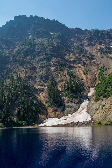
wintery remnants by vynsane, on Flickr
reflection of a phantom ship by vynsane, on Flickr
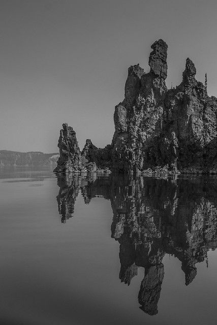
phantom ship mono by vynsane, on Flickr
holding on by vynsane, on Flickr
air, rock, and water by vynsane, on Flickr
wintery remnants by vynsane, on Flickr
reflection of a phantom ship by vynsane, on Flickr
phantom ship mono by vynsane, on Flickr
holding on by vynsane, on Flickr
air, rock, and water by vynsane, on Flickr
Re: Vynsane's Travelogue: Pacific Northwest Edition
After the Santa's Workshop interlude in my photostream, it's time to return to Crater Lake...
alien skies by vynsane, on Flickr
phantom ship, view astern by vynsane, on Flickr
phantom ship, port side by vynsane, on Flickr
phanto ship prow by vynsane, on Flickr
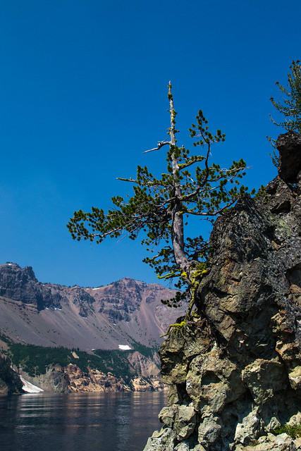
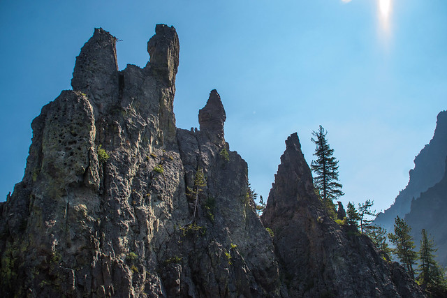
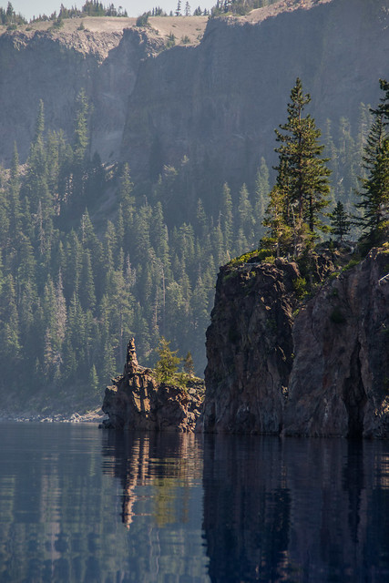
hanging gardens by vynsane, on Flickr
hanging gardens by vynsane, on Flickr
outcropping by vynsane, on Flickr
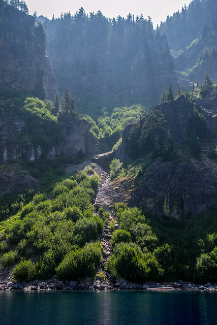
There was a research boat on the water while we took our tour, it looked so small compared to the surroundings.
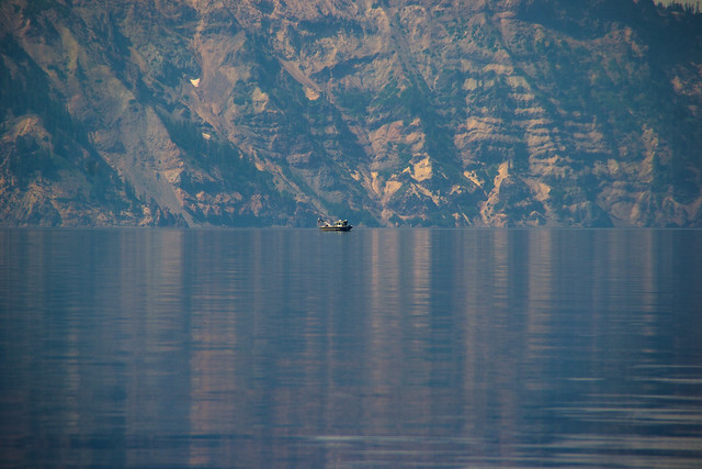
toy boat by vynsane, on Flickr
secret place by vynsane, on Flickr
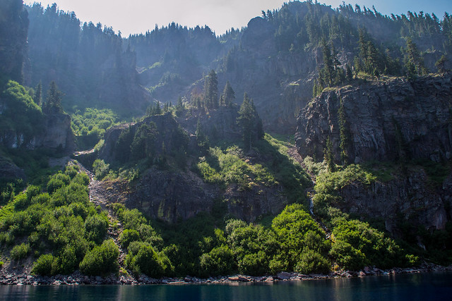
Compared to the hike down, the haze of the morning had dissipated so the air clarity was a lot better on the way back up.
haze has lifted by vynsane, on Flickr
Here's the next group in a boat identical to the one we were on. They use extremely high-octane gasoline (not diesel) in these boats so as to impact the surroundings as little as possible, and have to adhere to stringent inspections.
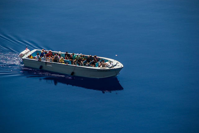
tour boat by vynsane, on Flickr
alien skies by vynsane, on Flickr
phantom ship, view astern by vynsane, on Flickr
phantom ship, port side by vynsane, on Flickr
phanto ship prow by vynsane, on Flickr
hanging gardens by vynsane, on Flickr
hanging gardens by vynsane, on Flickr
outcropping by vynsane, on Flickr
There was a research boat on the water while we took our tour, it looked so small compared to the surroundings.
toy boat by vynsane, on Flickr
secret place by vynsane, on Flickr
Compared to the hike down, the haze of the morning had dissipated so the air clarity was a lot better on the way back up.
haze has lifted by vynsane, on Flickr
Here's the next group in a boat identical to the one we were on. They use extremely high-octane gasoline (not diesel) in these boats so as to impact the surroundings as little as possible, and have to adhere to stringent inspections.
tour boat by vynsane, on Flickr


Re: Vynsane's Travelogue: Pacific Northwest Edition
Very nice shots especially the reflection ship one.

Re: Vynsane's Travelogue: Pacific Northwest Edition
Great pics man, keep posting!
Re: Vynsane's Travelogue: Pacific Northwest Edition
^ Thanks, both!
This post will round out our time at Crater Lake, from here we went on to Boise, ID.
These two shots really show the incline of the crater in relation to the trees.
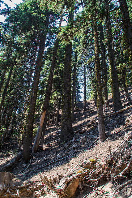
Cleetwood Trail trees by vynsane, on Flickr
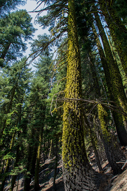
Cleetwood Trail trees by vynsane, on Flickr
After the hike back up the trail, we took the trolley tour around the entire caldera, which offered a vastly different perspective of the same sights.
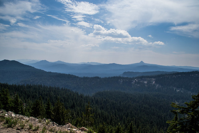
Forests and mountains from Rim Drive by vynsane, on Flickr
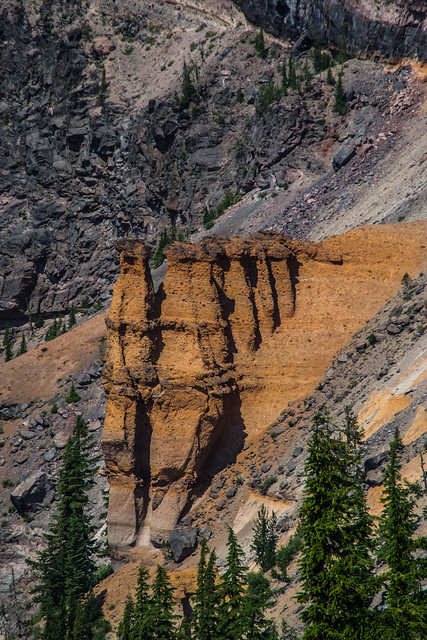
Pumice Castle by vynsane, on Flickr
Redcloud Cliff, Cloudcap Bay and Pumice Castle by vynsane, on Flickr
Wizard Island, Mount Scott by vynsane, on Flickr
Wizard Island and Devil's Backbone from Rim Drive by vynsane, on Flickr
Clouds above Crater Lake by vynsane, on Flickr
This post will round out our time at Crater Lake, from here we went on to Boise, ID.
These two shots really show the incline of the crater in relation to the trees.
Cleetwood Trail trees by vynsane, on Flickr
Cleetwood Trail trees by vynsane, on Flickr
After the hike back up the trail, we took the trolley tour around the entire caldera, which offered a vastly different perspective of the same sights.
Forests and mountains from Rim Drive by vynsane, on Flickr
Pumice Castle by vynsane, on Flickr
Redcloud Cliff, Cloudcap Bay and Pumice Castle by vynsane, on Flickr
Wizard Island, Mount Scott by vynsane, on Flickr
Wizard Island and Devil's Backbone from Rim Drive by vynsane, on Flickr
Clouds above Crater Lake by vynsane, on Flickr
Re: Vynsane's Travelogue: Pacific Northwest Edition
I like how you had time to do a lot of the trails n such at the places you visited. Last time I was down at the OR coast and Crater Lake I gave myself way too little time. Nice to see your pictures from the spots like Cape Foulweather and the boat tour down on the lake itself.
-
brickarmor
- Knight
- Posts: 376
- Joined: Mon Apr 30, 2012 7:08 am
- Location: SC, US
Re: Vynsane's Travelogue: Pacific Northwest Edition
You're like a drug dealer, drip-feeding my addiction when the goods are so far away. 
How did you get so close to Phantom Island? Boat, zoom, both? (Nevermind, I see the photo now which mentions the identical boat. But for my future plans, does it take you to both Wizard Island and Phantom Ship, and how long do they give you?)
I also encourage people who have never been to Crater Lake to hypnotize themselves into forgetting these pictures. There is nothing like hiking a crest and seeing it for the first time. We only had time to do Mt. Garfield, next time we'll spend days in Bend.
Re: Vynsane's Travelogue: Pacific Northwest Edition
Yes, we tried to pack in as much as possible into each day. Even still, there are some things I feel we skimped out on. I would have loved to have gotten close to Mt. Hood or Rainier when we were in Portland and Seattle, respectively.peanut wrote:I like how you had time to do a lot of the trails n such at the places you visited. Last time I was down at the OR coast and Crater Lake I gave myself way too little time. Nice to see your pictures from the spots like Cape Foulweather and the boat tour down on the lake itself.
HA! Sorry!brickarmor wrote:You're like a drug dealer, drip-feeding my addiction when the goods are so far away.
All tours depart from the Cleetwood Cove dock at the bottom of Cleetwood trail, which is a 700ft descent over the course of 1.1 miles. It's the only legal access to the water, and really the only viable hiking spot - everywhere else is just too loose, precipitous, or rough. So you're looking at 30-45 mins of hiking down before the tour and about 60-90 minutes hiking back up (it's roughly the equivalent of about 70 flights of stairs).How did you get so close to Phantom Island? Boat, zoom, both? (Nevermind, I see the photo now which mentions the identical boat. But for my future plans, does it take you to both Wizard Island and Phantom Ship, and how long do they give you?)
We took the 2 hour counter-clockwise circular tour around the lake that doesn't stop at Wizard Island, because we knew we wanted to do the Rim Dr. Trolley tour as well, and the tours that include Wizard Island wouldn't have let us do both. This tour departs six times a day, and we were on the first tour at 9:35am.
There are also two different Wizard Island tours - the 'half day' tour which takes you to the island and allows for 3 hours of hiking, then departs to continue the same loop as the 2 hour boat-only tour. They do this one twice a day, from 9:30am - 2:30pm, and 12:45pm - 5pm. Then there is the full-day tour which only takes the 45 min trip to Wizard Island and allows for 6 hours of hiking only, departing at 9:30am and picking you up at 5pm.
Whichever tour you decide on, book in advance. We were on a full boat and we saw many people hike the trail down only to get turned away because the tours were booked solid. They then could only wade/swim into the water near the dock for however long they wanted to linger before making the hike back up again. More info is available at http://www.craterlakelodges.com/activit ... t-cruises/

Re: Vynsane's Travelogue: Pacific Northwest Edition
Thanks for taking the time to post your vacation details & photos. I haven't been to that part of the country yet, but after seeing those photos I know I'll need to get out there soon.
Re: Vynsane's Travelogue: Pacific Northwest Edition
Wow!!! Those photos are amazing. I try to get away from the States or work once a year. I've been to many amazing places. My biggest problem is my fear of heights. I'm sure you've been on top of bear mountain where everybody takes pictures off the edge. Not me. Because of that it limits to what I can do.
Re: Vynsane's Travelogue: Pacific Northwest Edition
^ Thanks, I've really slacked off posting the rest, I still have Idaho, Montana and Washington to go!
I've been to Bear Mountain State Park, I took my daughter and niece to the zoo there, but we didn't make it to the overlook near the bridge, as the park was about to close. I have climbed Mount Beacon five or six times in the past couple of years, half of those times making it to the south peak fire tower, and once taking the full 7-mile loop around the next ridge (though I lost the trail and ended up walking down someone's driveway). Next I have to do Fishkill Ridge and basically walk from Mount Beacon to Cold Spring.
I've been to Bear Mountain State Park, I took my daughter and niece to the zoo there, but we didn't make it to the overlook near the bridge, as the park was about to close. I have climbed Mount Beacon five or six times in the past couple of years, half of those times making it to the south peak fire tower, and once taking the full 7-mile loop around the next ridge (though I lost the trail and ended up walking down someone's driveway). Next I have to do Fishkill Ridge and basically walk from Mount Beacon to Cold Spring.
Re: Vynsane's Travelogue: Pacific Northwest Edition
Finally got around to processing some more pics. From Crater Lake we drove eastward through Bend, OR.
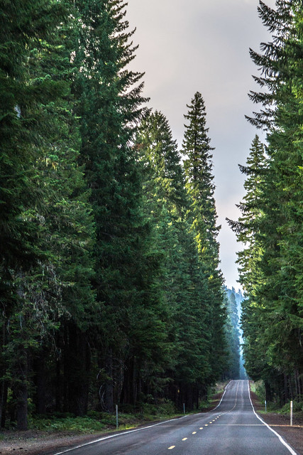
This is what it looks like driving in Oregon by vynsane, on Flickr
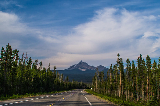
The road to Mt. Thielsen by vynsane, on Flickr
By the time we got to Crescent, OR it was dinner time, so, naturally we found one of the weirdest places to eat.
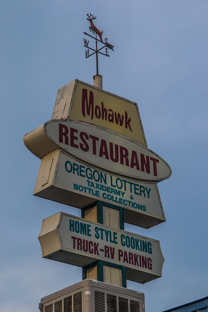
Oregon Lottery, Taxidermy & Bottle Collections by vynsane, on Flickr
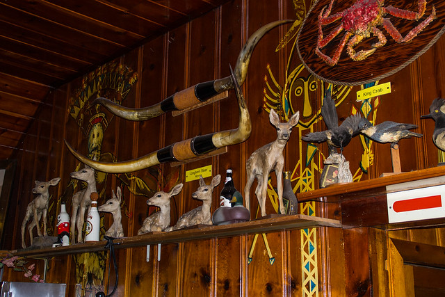
Mohawk Restaurant by vynsane, on Flickr
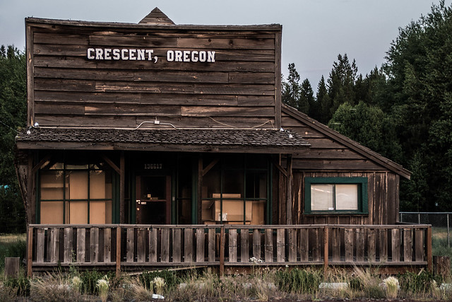
CRESCENT, OREGON by vynsane, on Flickr
We then drove through the night into Boise, Idaho. We neglected to notice that we were going to switch timezones, so what we planned to be an arrival in Boise at 2am extended to 3am, which became 4am due to the timezone change. Yikes. Needless to say, it took a long time to get out of the hotel that day. We went out for a late breakfast at BACON.
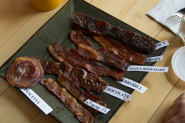
BACON!!! by vynsane, on Flickr
We then went back to the hotel, but I was running out of hard drive space so I actually went back into town to pick up a new external hard drive and then walked around a bit to get some pics of the area. Driving towards the Capitol, the dusty mountains behind it looked so great, but as I got closer they receded behind the building. The sky was so hazy because of nearby wildfires.

Capitol Blvd., Boise, ID by vynsane, on Flickr
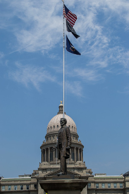
Lincoln and the Capitol dome by vynsane, on Flickr
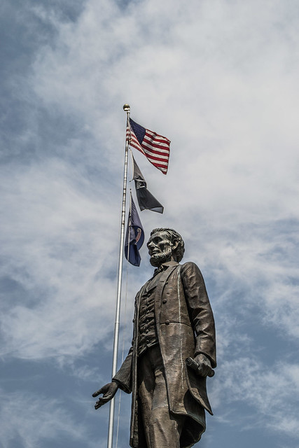
Lincoln by vynsane, on Flickr
I managed to find a good vantage point from the top of a parking garage across the street.
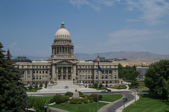
Capitol Building, Boise, ID by vynsane, on Flickr
It was over 100°F in Boise that day. This group of women were all daring themselves and each other to run through this fountain. She was the first:
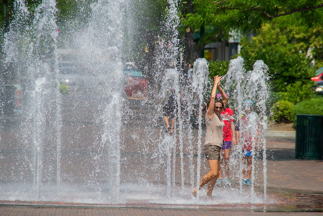
cooling off by vynsane, on Flickr
We had planned to go to a water park that day, but getting out of the hotel so late, on a day where it was 100° and, as we found out when we go there, on BARGAIN DAY, the place was PACKED, so we just turned around and wrote the day off. The next day we were supposed to raft down the Boise River, but it was, somehow, too cold! Over all, Boise was a bust.
We next made our way to Idaho City, ID.
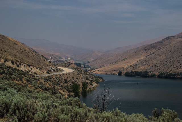
Lucky Peak Lake by vynsane, on Flickr
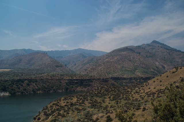
Lucky Peak Lake by vynsane, on Flickr
We first hit the Ranger Station.
Idaho City Ranger Station by vynsane, on Flickr
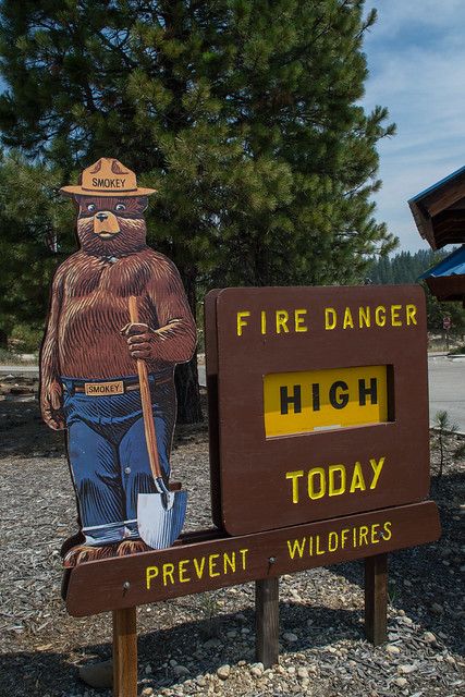
Oh, good. Wouldn't want it to be "Medium" by vynsane, on Flickr
While we were there we heard about this crazy "antiques" (junk) store, apparently known as "The Sluice Box":
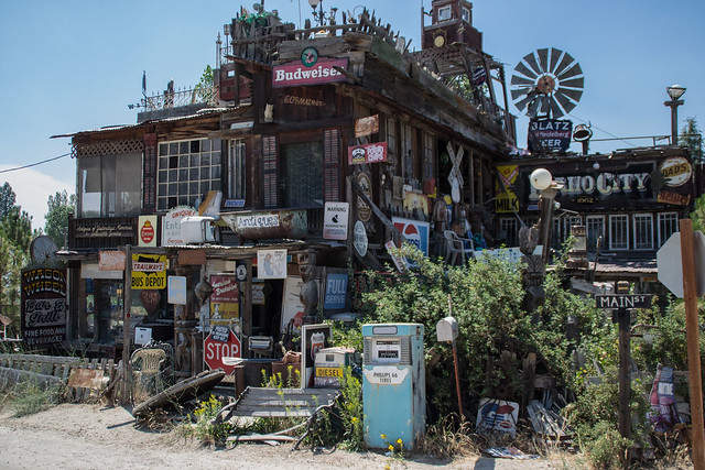
The Sluice Box by vynsane, on Flickr
This is what it looks like driving in Oregon by vynsane, on Flickr
The road to Mt. Thielsen by vynsane, on Flickr
By the time we got to Crescent, OR it was dinner time, so, naturally we found one of the weirdest places to eat.
Oregon Lottery, Taxidermy & Bottle Collections by vynsane, on Flickr
Mohawk Restaurant by vynsane, on Flickr
CRESCENT, OREGON by vynsane, on Flickr
We then drove through the night into Boise, Idaho. We neglected to notice that we were going to switch timezones, so what we planned to be an arrival in Boise at 2am extended to 3am, which became 4am due to the timezone change. Yikes. Needless to say, it took a long time to get out of the hotel that day. We went out for a late breakfast at BACON.
BACON!!! by vynsane, on Flickr
We then went back to the hotel, but I was running out of hard drive space so I actually went back into town to pick up a new external hard drive and then walked around a bit to get some pics of the area. Driving towards the Capitol, the dusty mountains behind it looked so great, but as I got closer they receded behind the building. The sky was so hazy because of nearby wildfires.
Capitol Blvd., Boise, ID by vynsane, on Flickr
Lincoln and the Capitol dome by vynsane, on Flickr
Lincoln by vynsane, on Flickr
I managed to find a good vantage point from the top of a parking garage across the street.
Capitol Building, Boise, ID by vynsane, on Flickr
It was over 100°F in Boise that day. This group of women were all daring themselves and each other to run through this fountain. She was the first:
cooling off by vynsane, on Flickr
We had planned to go to a water park that day, but getting out of the hotel so late, on a day where it was 100° and, as we found out when we go there, on BARGAIN DAY, the place was PACKED, so we just turned around and wrote the day off. The next day we were supposed to raft down the Boise River, but it was, somehow, too cold! Over all, Boise was a bust.
We next made our way to Idaho City, ID.
Lucky Peak Lake by vynsane, on Flickr
Lucky Peak Lake by vynsane, on Flickr
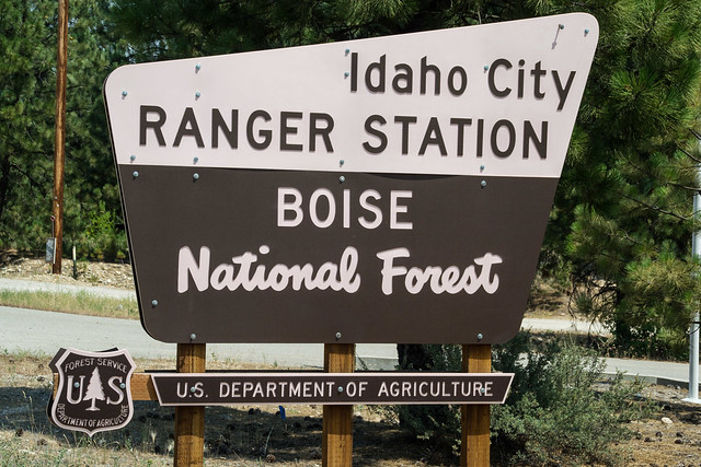
We first hit the Ranger Station.
Idaho City Ranger Station by vynsane, on Flickr
Oh, good. Wouldn't want it to be "Medium" by vynsane, on Flickr
While we were there we heard about this crazy "antiques" (junk) store, apparently known as "The Sluice Box":
The Sluice Box by vynsane, on Flickr
Re: Vynsane's Travelogue: Pacific Northwest Edition
Some more from Idaho City:
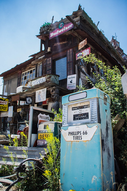
The Sluice Box by vynsane, on Flickr
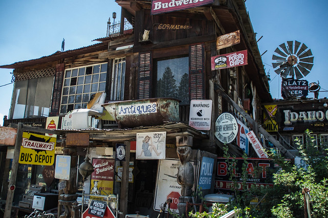
ANTIQUES by vynsane, on Flickr
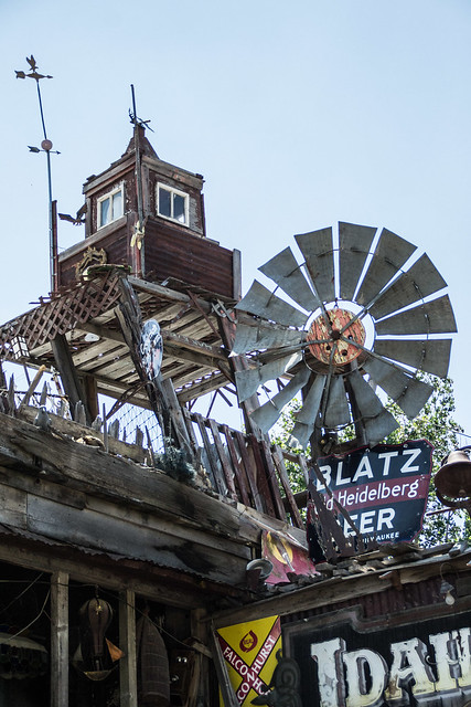
BLATZ by vynsane, on Flickr

ROOT BEER by vynsane, on Flickr

lamp by vynsane, on Flickr
From there we drove north into Idaho City Backcountry for our next adventure - sleeping in a yurt at 6569' elevation!
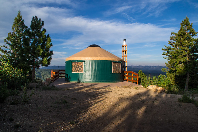
Stargaze Yurt by vynsane, on Flickr
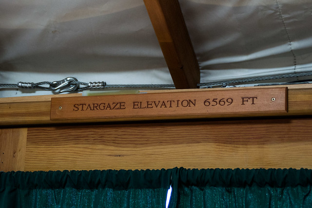
6569' by vynsane, on Flickr
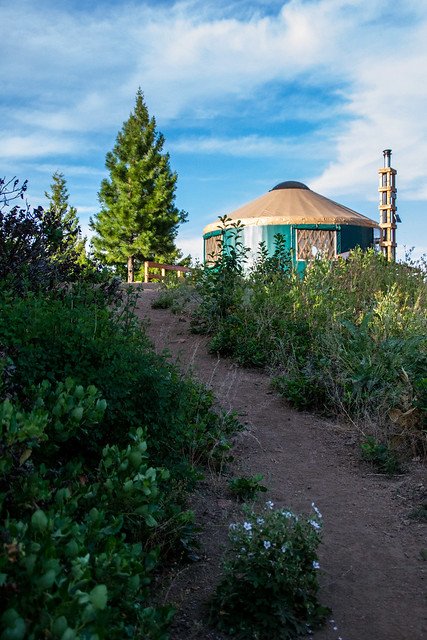 [
[
url=https://flic.kr/p/q54EQ8]Stargaze Yurt path[/url] by vynsane, on Flickr
From the yurt, a short trail led to the highest point in the area, Stargaze Point, topping out at 6,682'

Stargaze Point by vynsane, on Flickr
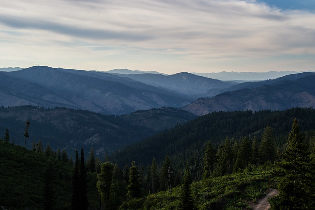
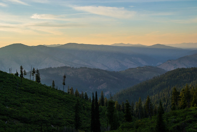
The views of the surrounding Boise National Forest were astounding, particularly from this one area where the trees had been cleared and a bench had been placed. I kept going back to take more pictures of the same area as the light changed.
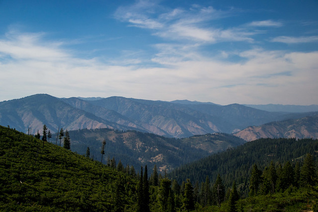
Boise National Forest by vynsane, on Flickr
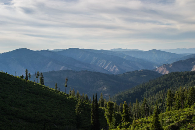
shadows creep by vynsane, on Flickr
changing light by vynsane, on Flickr
 rays of gold by vynsane, on Flickr

sunset skies by vynsane, on Flickr
The Sluice Box by vynsane, on Flickr
ANTIQUES by vynsane, on Flickr
BLATZ by vynsane, on Flickr
ROOT BEER by vynsane, on Flickr
lamp by vynsane, on Flickr
From there we drove north into Idaho City Backcountry for our next adventure - sleeping in a yurt at 6569' elevation!
Stargaze Yurt by vynsane, on Flickr
6569' by vynsane, on Flickr
[url=https://flic.kr/p/q54EQ8]Stargaze Yurt path[/url] by vynsane, on Flickr
From the yurt, a short trail led to the highest point in the area, Stargaze Point, topping out at 6,682'
Stargaze Point by vynsane, on Flickr
The views of the surrounding Boise National Forest were astounding, particularly from this one area where the trees had been cleared and a bench had been placed. I kept going back to take more pictures of the same area as the light changed.
Boise National Forest by vynsane, on Flickr
shadows creep by vynsane, on Flickr
changing light by vynsane, on Flickr
rays of gold by vynsane, on Flickrsunset skies by vynsane, on Flickr
Who is online
Users browsing this forum: No registered users and 11 guests